



Winter Farm Planning: A Stone Picking Checklist Before Spring Seeding
The combine is parked and the repair bills are on the desk. That makes now the right time for winter farm planning. The calls you make between now and spring decide which quarters your crew works first, how many hours stone picking takes, and how much equipment you put at risk at harvest.
This guide covers the winter decisions that touch stones, what information each one needs, and where a TerraClear Rock Map fits.
Key takeaways
- Winter farm planning is when you set spring crew, hours, and field order. Those calls are cheaper to make on paper than in the field.
- Last fall’s stone damage tells you which quarters to deal with first.
- Frost heave pushes new stones up every winter, so the map you pick from should fly right before seeding.
- Buying map acre credits in winter lets you choose fields and flight timing once your seeding plan is set.
What is winter farm planning?
Winter farm planning is the work you do between harvest and spring to set next season’s plan: which fields get attention first, who is on the crew, what equipment needs fixing, and how seeding will run. For small grain and canola operations on the Prairies, stones are one of the biggest swing factors. They eat crew time in the spring, and they break equipment at harvest. Both problems are easier to manage when you know where the stones are before you roll.
Costs make the planning matter. USDA cost projections reported by Farms.com show production costs climbing for every major crop, with seed, chemical, labour, machinery, and repairs all adding pressure. A stone through the combine is one of the few repair bills you can see coming.
What should be on your winter farm planning checklist?
Start with the decisions that are hardest to change once spring hits.
| Winter decision | What you need to make it | When it pays off |
|---|---|---|
| Fix last fall’s stone damage | Repair records by quarter | Before seeding |
| Rank quarters for stone picking | Which fields carry the most stones | Spring field work |
| Assign spring crew and hours | A realistic picking plan per field | Seeding window |
| Decide what to pick by hand vs. with equipment | Stone sizes by field | Spring field work |
| Book mapping flights | Map acre credits and a field list | Right before seeding |
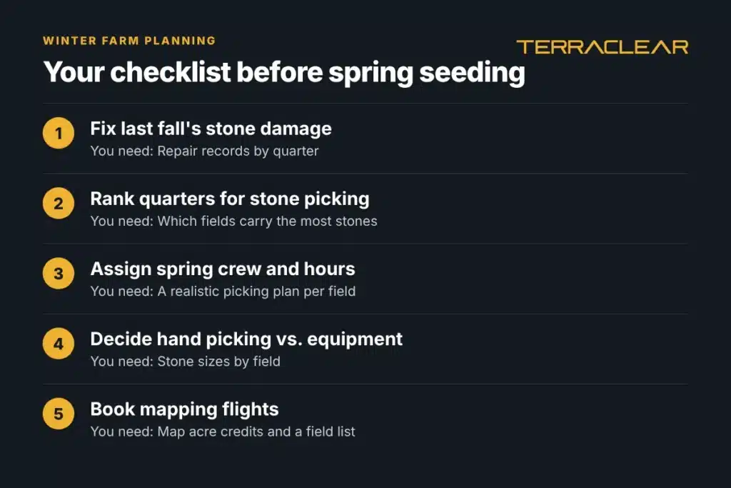
The sections below take these one at a time.
How do you plan stone picking before spring?
Start with last fall. Pull the repair tickets and note which quarters did the damage. Those go to the top of the list.
Then plan for what’s coming. Stones keep showing up in fields you picked clean because of frost heave. The North Dakota Geological Survey explains that ice lenses form in the soil as it freezes, lift the ground, and carry stones up with it. Fine-textured glacial silts and loams, common across the northern Prairies, are the most prone to it. So a map flown last fall won’t show what the winter brings up. The map you pick from should fly in spring, once the ground is open and before seeding.
Here’s how a winter stone plan comes together:
- List your stoniest quarters from repair records and crew memory.
- Decide who picks. Your own crew can pick from a TerraClear Rock Map, or TerraClear can connect you with an independent stone picking operator.
- Buy map acre credits for the fields you’ll map. You pick exact fields and flight timing later.
- Fly before seeding. The map lands in the TerraClear app the next day on average, with a precision plan (the field-by-field action list that comes with your map) and a pick route.
- Pick from the route, densest fields first.
Wayne Drangshol, of Mohall, North Dakota, described the old way plainly: “Each spring, I relied on memory from the previous fall to recall where rocks had been identified, then spent valuable time driving fields in search of those locations.”
For more on timing, see fall stone picking and how to choose GPS for stone picking.
How do stone sizes change your spring plan?
Stone size decides what equipment you send. A TerraClear Rock Map marks stones 8″ and larger at a GPS-pinpointed location and shows a photo of each one, so you can see sizes before anyone leaves the yard.
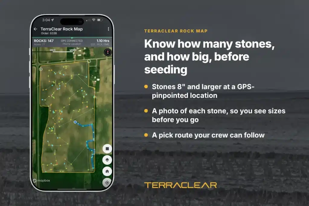
Jordan Schmidt, who farms in Saskatchewan, used that to change his whole approach: “Seeing rock sizes ahead of time meant I didn’t need the tractor. I knew exactly which ones I could pick by hand allowing me to modify the equipment required and speed up the time picking.”
On one field, the difference was hours: “A 273-acre field would normally take six to seven hours with a tractor. Using the map, I was able to pick it in just an hour and a half with the side-by-side.”
When you plan crew and equipment in winter, ask two questions for each quarter: how many stones, and how big. The map answers both before seeding.
How much can one stone cost you?
More than most people budget for. Flaman, a Western Canada equipment dealer, notes that a stone through a combine used to mean “a few hundred to maybe a couple thousand” in damage. With today’s faster, higher-capacity machines, repairs can run “tens of thousands of dollars.”
The damage also spreads. In AgWeb, Dan Anderson lists feeder house chains, concave linkages, sieves, chopper housings, and grain augers as places a stone can do harm after it gets past the header. He also notes that insurers often want rock damage claims within six weeks of the end of harvest.
Robert Semeniuk, a Canadian farmer, put his reason simply: “TerraClear is going to help me be super efficient picking rocks and help save my equipment.”
How do map acre credits work for winter planning?
You buy map acre credits now and decide the details later. Here’s the order:
- Buy map acre credits online or in the TerraClear app.
- Pick your fields and flight time once your seeding plan is set.
- Every acre gets flown. TerraClear maps the whole field, not a sample.
- Put the map to work. Hand your crew the pick route.
There’s nothing to chase in spring. Step-by-step instructions are in how to order stone and weed maps.
What do farmers say after planning with a map?
TerraClear has mapped more than 1.5 million acres across over 1,000 farm operations, according to TerraClear. Farmers find about 3x more stones and pick about 3x faster with a TerraClear Rock Map.
Jordan Schmidt noticed the photos most in residue: “The photos made a big difference, especially in the fall when residue covers the field. They made rocks easy to find.”
Michael Rostad, of White Earth, North Dakota: “TerraClear is a game changer for picking rocks. Once your field has been mapped, anyone can go efficiently and confidently clear the field.”
Right after harvest. Repair records and field notes are fresh, and you have time to line up crew, equipment, and mapping before seeding.
Credits let you hold your mapping now and choose fields and flight timing once your seeding plan is set. By purchasing acre credits now, you secure the best price of the season.
For Winter Planning purposes, right before seeding, once the ground is open. That way the map shows stones that frost heave pushed up over the winter. Additionally, TerraClear can map stones in your fields post seeding or post harvest.
The map is in your TerraClear app the next day on average, with a precision plan and a pick route.
No. TerraClear makes the map. Your crew picks from it, or TerraClear can connect you with an independent stone picking operator.
No map catches everything. A TerraClear Rock Map marks stones 8″ and larger at a GPS-pinpointed location. Farmers using a TerraClear Rock Map find about 3x more stones AND pick 3x faster. A Rock Map gives you a precision plan and allows your farm to operate much more efficiently.
TerraClear maps in Alberta, Saskatchewan, and Manitoba, plus in the Northern Plains and Midwest in the United States of America.
Ready to plan your spring?
Tell us which quarters are on your list. A specialist will help you set up your account and get your acres ready. Or call TerraClear at (712) 545-7144.