


Find TerraClear in The Book
TerraClear is now listed in The Book, the farm equipment and services directory from FarmPages. The Book reaches more than 150,000 farms across Canada and the US in print and online. Find us under Precision Farming, or go straight to TerraClear on FarmPages.
What TerraClear does
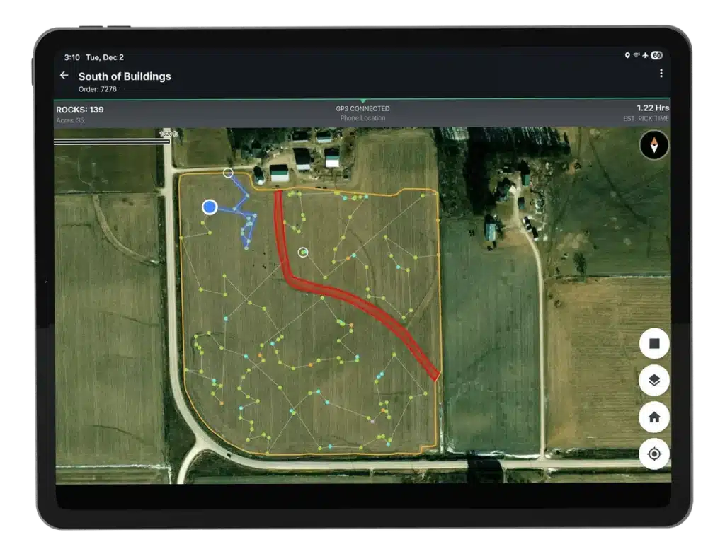
TerraClear maps the stones in your fields using high-resolution aerial imagery and AI. The next day, you get more than a map: each stone pinned with a photo and GPS location, plus an optimized pick route for your crew.
How rock mapping works
- We fly your fields, capturing up to 1,000 acres per day.
- AI finds the stones in the imagery.
- Your map is back the next day.
- Your crew picks with the TerraClear app and marks each stone as picked.
What you get in the app
- Filter the map by the stone size you care about
- Follow an optimized pick route
- Share the map with your pick crew and track progress live
- Works without cell service and uploads when you are back online
Growers find 3x more stones and pick 3x faster. Pick with your own crew or equipment, or hire an independent service provider. There is no equipment to buy.
Where TerraClear is available
TerraClear maps fields in Alberta, Saskatchewan and Manitoba, for wheat, canola, corn and soybeans. Learn more about rock mapping.
Common questions
The Book is a directory of farm equipment, supplies and services for growers in Canada and the US, published in print and online at farmpages.com.
Maps are delivered the next day after image capture.
No. TerraClear maps them. You pick with your own crew or equipment, or hire an independent service provider.
Yes. It uploads progress when you are back online.
Get your map
Order a Rock Map, or find us in The Book.
Check before publishing: the order link points to the .ca homepage because I did not confirm a .ca order page URL.